| METEO EMBATS AUCH GERS | |||
|---|---|---|---|
| Dernière mise à jour à : 10:35 AM le :September 16 2026, time of next update: 10:40 am | |||
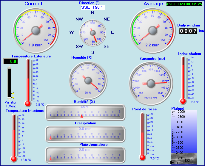
| Météo actuelle | Dry | Température actuelle | 19.6°C (67.3°F) (Température 19.6°C ), Apparent temp 18.1°C |
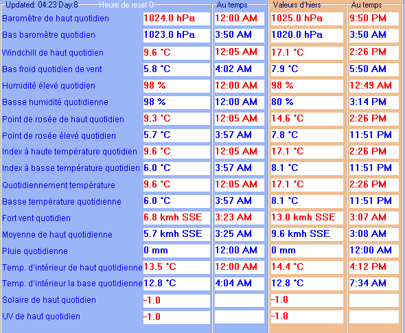
| Temperature Maximum (depuis minuit) | 20.3°C at: 12:50 AM | Temperature Minimum (depuis minuit) | 17.2°C at: 7:51 AM |
| Vitesse moyenne du vent (dix minutes) | 6.5 kmh (3.5 kts) | Direction du vent (dix minutes) | NW (311°) |
| Température des rafales | 19.6°C | Rafale maximum (dernière heure) | 15.2 kmh (8.2 kts) at: 10:14 AM |
| Rafale maximum (depuis minuit) | 22.2 kmh (12.0 kts) at: 12:21 AM | Maximum des moyennes à 1mn (depuis minuit) | 12.2 kmh (6.6 kts) at: 12:17 AM |
| Précipitation (dernière heure) | 0.0 mm | Précipitation (depuis minuit) | 0.0 mm (0.00 in.)--- |
| Précipitation Ce mois ci | 3.0 mm (0.12 in.) | Précipitation To date this year | 511.2 mm (20.13 in.) |
| Précipitation maximum par minute (dernière heure) | 0.0 mm/min | Précipitation maximum par heure (dernières 6 heures) | 0.0 mm/Heure |
| Précipitations de hier | 0.0 mm | Point de rosée | -1.0°C (Wet Bulb :10.7°C ) |
| Humidité | 25 %, Humidex 17.2°C | Barometre corrected to msl | 1022.0 mb |
| Evolution de la pression | -1.0 mb (dernière heure) | Tendance (dernières 1 heure) | CONSTANT |
| Evolution de la pression dernières 12 heures) | +1.0 mb | Evolution de la pression (dernières 6 heures) | +0.0 mb |
| Current Intér. Temp. 24.5°C | |||
| Current Intér. hum. 44% | |||
Use the RELOAD facility on your browser to retrieve the latest data.